Days when Burnley was a charming little village


Since then, a number of people have contacted me and told me how much they enjoyed the short programme. They added they did not realise just how interesting that part of Burnley remains and how much has survived from the past.
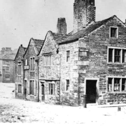
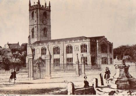
Church Street, as it is with many other Church Streets in other communities, is Burnley’s oldest street. It was, and remains, the street which led from the south to the “church” of St Peter and, over the years, other streets were added to the original.
Advertisement
Hide AdAdvertisement
Hide AdOne of the first was Godley Lane, the lane which led from the church to the village’s open fields. Another was Fenkin (otherwise Finkle) Street which was the name for Church Street on the north bank of the Brun and the last of the early streets was Cuckstool Lane which followed the short course of the present School Lane.
This article is not really about street names but, as the meanings of a few of these early names are interesting, please excuse this little diversion. “Godley” strictly means “God’s field” or “God’s clearing”. It could mean the land had been owned by the Church and indeed that is a likely derivation as quite a lot of land in the centre of the old village of Burnley was owned by the Church in the form of the Abbey of Whalley. In fact the abbey had a small grange in Church Street. Godley Lane followed a similar route to the modern Ormerod Road and the bridge over the canal, above the Thompson Park gates, is still known as the Godley Bridge.
Fenkin Street is a little more complex. The only realistic derivation of the name is Norse in origin and it refers to a bend, as in the bend seen in an elbow. This could mean the original Fenkin Street, which is the name for the continuation of Church Street from the north bank of the river to roughly where the Grammar School Gardens are now, got its name as there was a bend in the lane. This would seem to be probable and there is a slight bend to the right in the road today.
Cuckstool Lane is pretty easy. It could mean only one thing – there was a ducking stool somewhere along what is now School Lane. A ducking stool was a medieval form of punishment though its origins lay in the fact that at first “ducking” was used to determine whether someone was innocent of a particular charge or not. We know this as “trial by water” which was practiced by both the Saxons and their enemies the Vikings. In later years ducking appears to have been commuted, if that is the right word, to punishment only, talkative women often the victims. Burnley’s ducking stool seems to have been located at the top of the lane a little beyond the site of the Old Grammar School.
Advertisement
Hide AdAdvertisement
Hide AdBefore we leave the subject of Burnley’s early street names we should not forget there were at least two other early streets in Burnley. These were Bridge Street and Mill Street both of which led to the ancient corn mill which was situated between the little village of Burnley, on the Brun, and Bridge End, otherwise Windle, a small collection of properties on the river Calder at the bottom of what is now Westgate.
Bridge Street gave access to the mill from the road, now St James’s Street, which linked Burnley and Bridge End. Mill Street, in the early days little more than a path, gave access to the mill from the north where there was a series of paths which connected Burnley to the farming lands of Royle, Barden and further afield.
It was this connectivity which gave Burnley its ultimate pre-eminence in this part of Lancashire. The road which linked Bridge End to the village of Burnley was the main road in the district but, as early as the Middle Ages, there were others. Burnley was linked to the towns of the West Riding of Yorkshire by the Long Causeway which ran from Towneley towards Heptonstall. There was another road, which led from Gannow to Rochdale and on to Manchester and a route led through Ightenhill to Higham, Whalley and Clitheroe. The road from Bridge End led to Padiham and then to Blackburn and Preston.
However, Burnley was not in the same league as Blackburn which gave its name to our part of East Lancashire. In early documents the area is called Blackburnshire, though, properly, Blackburn, along with Leyland, Salford and other towns, was one of Lancashire’s “Hundred” towns in that a division of the county was known as the Hundred of Blackburn. In later years Burnley grew into having the leading role in the Upper Division of the Blackburn Hundred whereas Blackburn itself retained that role for the Lower Division.
Advertisement
Hide AdAdvertisement
Hide Ad